THOMSON JOHN ( CA. 1777-CA.1840 ) EDITEUR ET CARTOGRAPHE
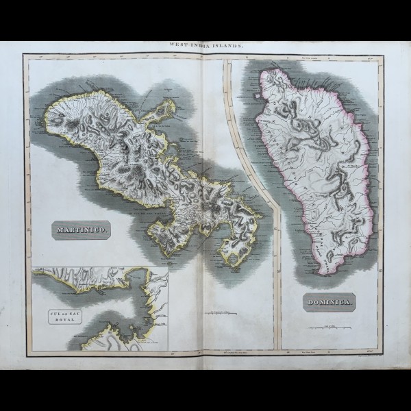
WEST INDIA ISLANDS, MARTINICO, DOMINICA
Map of the islands of Martinique and Dominica, and an enlarged detail of the "Cul de Sac Royal" (pre..
280.00 €
1 to 1 of 1 (1 Pages)



Map of the islands of Martinique and Dominica, and an enlarged detail of the "Cul de Sac Royal" (pre..
280.00 €
Answers on the authenticity, conservation and acquisition of Japanese prints and Master engravings.
En résumé : The prints are protected in a neutral acid-free pouch, packaged strictly flat between two plates of rigid reinforced non-deformable cardboard with ad valorem insurance.
Prints are preferably shipped flat to preserve the fiber of the paper. Packages are shipped within 24 to 48 hours via Colissimo Expert with delivery against signature or express carrier (DHL / FedEx) with tracking number. Collection by hand from our Parisian gallery (11 Passage Verdeau) is also available during opening hours or on request.
En résumé : An original print is verified by its edition, determined largely by the nature of its paper and the quality of its printing.
At the Maillard-Fouilleul Gallery, each work undergoes an in-depth examination, mention in the dedicated catalogs or directories, quality of the print and printing, possible presence of a watermark and its identification as well as any signature, sending or collector's mark, state of conservation of the print, integrity of the margins.
En résumé : Ukiyo-e (17th–19th century) illustrates the classic “floating world” of Edo, while Shin-Hanga (20th century) renews woodcut with Western perspectives and light effects.
Ukiyo-e brings together illustrious masters like Hokusai, Hiroshige, Utamaro and Sharaku. The favorite subjects are actors, kabuki, courtesans or Bijin and landscapes, nature and its seasons being at the heart of art and the art of living in Japan. The Shin-Hanga (“new prints”) movement, launched by the publisher Watanabe Shozaburo in the years 1915-1960 with Hasui Kawase and Hiroshi Yoshida, preserves the traditional technique on wood with the intervention of a designer, an engraver and a printer, while infusing a spectacular atmospheric realism. To this we must add Sosaku-Hanga ("creative prints"), the creative process of which is in the hands of the artist alone and whose palette and graphic expression are freer.
En résumé : Store prints away from UV rays and excessive humidity. Use only acid-free (neutral pH) mats and museum-quality anti-UV glass.
Inks like paper are very sensitive to direct light and humidity. We recommend reversible assembly with neutral pH or Japanese starch-based hinges, avoiding any synthetic adhesive. Never glue a print in full. For storage in drawing board, choose neutral polyester pouches (Melinex/Mylar) and permanent blotting paper.
En résumé : Yes, we examine your works for cash purchase, or valuation notice on photographs.
We are constantly looking for Japanese prints (Ukiyo-e, Shin-Hanga, Sosaku-Hanga), as well as engravings by ancient or modern European masters: Dürer, Callot, Bosse, Nanteuil, Boucher, Delacroix, Gericault, Goya, Rodin, Redon, Miro, Chagall, Buffet, Delaunay, Vasarely. You can send us photos by email to maillard.estampes@orange.fr or come and meet us directly at Passage Verdeau in Paris.
Galerie Maillard-Fouilleul · Specialist in ancient and modern prints · Ref. bibliographic: Hollstein, Bartsch, Le Blanc, I.F.F, Delteil, Last update: 09/2026.